| Red (Warning) | |
| Orange (Watch) | |
| Yellow (Advisory) | |
| Green (Normal) | |
| Uninstrumented |
Aleutians
(52.0765, -176.1109)2025-03-30 18:32:33 UTC
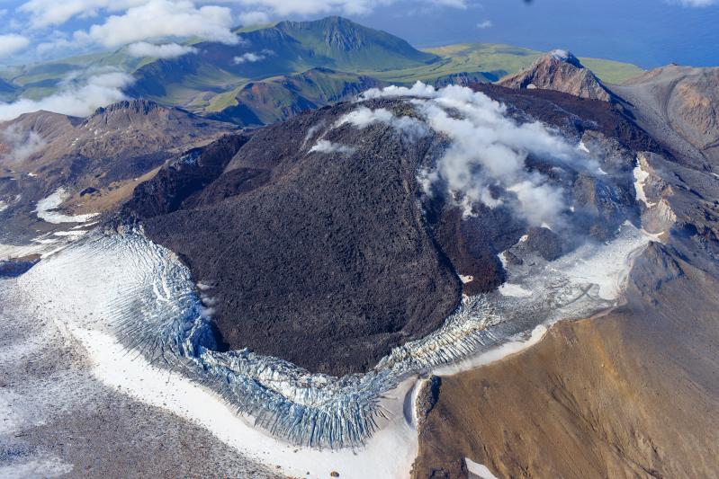
Lava continues to erupt slowly in the summit crater of Great Sitkin Volcano, and small earthquakes continue at a low rate. Weakly elevated surface temperatures observed in satellite data. No activity observed in web camera imagery.
The current eruption of Great Sitkin Volcano began with a single explosive event in May 2021. The ongoing eruption of lava at the summit began shortly afterward, in July 2021. The volcano is monitored using local seismic and infrasound sensors, satellite data and web cameras, and regional infrasound and lightning networks.
Cook Inlet-South Central
(61.2989, -152.2539)2025-03-30 18:32:33 UTC
Unrest continues at Mount Spurr volcano. Seismicity remains elevated with numerous small, shallow volcanic earthquakes detected beneath the volcano over the past day. No activity detected in satellite data. Minor steaming from the summit observed in web camera imagery.
AVO continues monitoring activity at Mount Spurr for signals indicating that the volcano is moving closer to an eruption. Based on previous eruptions, changes from current activity in the earthquakes, ground deformation, summit lake conditions, and fumarolic activity would be expected if magma began to move closer to the surface. Therefore, if an eruption occurred, it would be preceded by additional signals allowing warning.
The volcano is monitored using local seismic, infrasound, web camera, and GNSS stations along with regional infrasound, lightning networks and satellite data.


