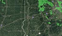
...FLOOD WATCH REMAINS IN EFFECT THROUGH SUNDAY MORNING...

* WHAT...Flooding caused by excessive rainfall continues to be
possible.

* WHERE...All of Central Indiana

* WHEN...Through Sunday morning.

* IMPACTS...Excessive runoff may result in flooding of rivers,
creeks, streams, and other low-lying and flood-prone locations.
Extensive street flooding and flooding of creeks and rivers are
possible.

* ADDITIONAL DETAILS...
- Multiple rounds of heavy rainfall will impact central Indiana
through early Sunday.
- http://www.weather.gov/safety/flood

PRECAUTIONARY/PREPAREDNESS ACTIONS...

You should monitor later forecasts and be alert for possible Flood
Warnings. Those living in areas prone to flooding should be prepared
to take action should flooding develop.

&&
...The National Weather Service in Indianapolis IN has issued a
Flood Warning for the following rivers in Indiana...Illinois...

Wabash River.

.Significant flooding is expected to develop in the Wabash River
basin due to several rounds of heavy rainfall through Sunday. The
current forecast includes three to seven inches of rain over 72
hours in the Wabash basin, but does not include the final round of
heavy rainfall expected Saturday and Saturday night, so crests may
be higher than those currently forecast and last longer.

PRECAUTIONARY/PREPAREDNESS ACTIONS...

Turn around, don't drown when encountering flooded roads. Most flood
deaths occur in vehicles.

Additional information is available at www.weather.gov/ind.

The next statement should be issued Thursday afternoon by around 115
PM EDT /1215 PM CDT/.

&&

...FLOOD WARNING IN EFFECT FROM FRIDAY EVENING UNTIL FURTHER
NOTICE...

* WHAT...Moderate flooding is forecast.

* WHERE...Wabash River at Clinton.

* WHEN...From Friday evening until further notice.

* IMPACTS...At 24.0 feet, Critical stage is reached on agricultural
levees in northern Vigo County.  Extensive flooding of
agricultural lands is in progress.  Flooding of low residential
property in southeast Clinton begins.  Some high county roads are
impassable.  River Park at Clinton is completely flooded.  Old SR
63 north of Clinton begins to flood.

* ADDITIONAL DETAILS...
- There is no current observed data.
- Forecast...The river is expected to rise above flood stage
late Friday evening and continue rising to a crest of 25.2
feet Sunday morning.
- Flood stage is 18.0 feet.
- http://www.weather.gov/safety/flood

&&
...The National Weather Service in Indianapolis IN has issued a
Flood Warning for the following rivers in Indiana...Illinois...

Wabash River.

.Significant flooding is expected to develop in the Wabash River
basin due to several rounds of heavy rainfall through Sunday. The
current forecast includes three to seven inches of rain over 72
hours in the Wabash basin, but does not include the final round of
heavy rainfall expected Saturday and Saturday night, so crests may
be higher than those currently forecast and last longer.

PRECAUTIONARY/PREPAREDNESS ACTIONS...

Turn around, don't drown when encountering flooded roads. Most flood
deaths occur in vehicles.

Additional information is available at www.weather.gov/ind.

The next statement should be issued Thursday afternoon by around 115
PM EDT /1215 PM CDT/.

&&

...FLOOD WARNING IN EFFECT FROM THURSDAY AFTERNOON UNTIL FURTHER
NOTICE...

* WHAT...Moderate flooding is forecast.

* WHERE...Wabash River at Montezuma.

* WHEN...From Thursday afternoon until further notice.

* IMPACTS...At 25.5 feet, Extensive lowland flooding in progress.
The eastern most part of Vermillion CR 600 S impassable just north
of U.S. 36.  The lowest portions of Wabash Road west of Parke CR
600 W begin to flood.  Montezuma Public Access Site and low
portions of Montezuma Park under water.

* ADDITIONAL DETAILS...
- At 2:45 PM EDT Wednesday the stage was 7.1 feet.
- Forecast...The river is expected to rise above flood stage
tomorrow afternoon and continue rising to a crest of 25.2
feet Sunday morning.
- Flood stage is 14.0 feet.
- http://www.weather.gov/safety/flood

&&
...The National Weather Service in Indianapolis IN has issued a
Flood Warning for the following rivers in Indiana...Illinois...

Wabash River.

.Significant flooding is expected to develop in the Wabash River
basin due to several rounds of heavy rainfall through Sunday. The
current forecast includes three to seven inches of rain over 72
hours in the Wabash basin, but does not include the final round of
heavy rainfall expected Saturday and Saturday night, so crests may
be higher than those currently forecast and last longer.

PRECAUTIONARY/PREPAREDNESS ACTIONS...

Turn around, don't drown when encountering flooded roads. Most flood
deaths occur in vehicles.

Additional information is available at www.weather.gov/ind.

The next statement should be issued Thursday afternoon by around 115
PM EDT /1215 PM CDT/.

&&

...FLOOD WARNING IN EFFECT FROM FRIDAY MORNING UNTIL FURTHER
NOTICE...

* WHAT...Moderate flooding is forecast.

* WHERE...Wabash River at Terre Haute.

* WHEN...From Friday morning until further notice.

* IMPACTS...At 25.0 feet, Extensive flooding is in progress.
Greenfield Bayou levee may leak.  South Lake area extensively
floods. Many local roads are under several feet of water.

* ADDITIONAL DETAILS...
- At 2:30 PM EDT Wednesday /1:30 PM CDT Wednesday/ the stage
was 7.7 feet.
- Forecast...The river will rise above flood stage Friday
morning to 25.0 feet Sunday evening and oscillate there.
- Flood stage is 16.5 feet.
- http://www.weather.gov/safety/flood

&&


