Webcams nearby
Kaeo - Water level
Webcams nearby


Advertisements
Description
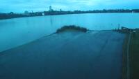
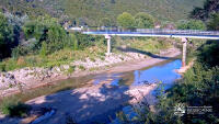
The camera monitors water levels in the Kaeo River, which frequently floods State Highway 10 near the Kaeo Fire Station. The thumbnail is a preview. The current webcam view is available on the external website.
Time
2026-02-07 15:42 NZDT
Provider website
Refresh
Image update: 5+ sec
Advertisements
Weather station
Temperature: 17 °C (63 °F)
Precipitation: 0.0 mm
Cloud cover: 86%
Wind speed: 7 km/h (4 mph)
Precipitation: 0.0 mm
Cloud cover: 86%
Wind speed: 7 km/h (4 mph)
Wind direction: 213 °
Pressure: 1019 hPa
Humidity: 93%
Visibility: 10 km
Pressure: 1019 hPa
Humidity: 93%
Visibility: 10 km
Sunrise: 06:48 am
Sunset: 08:28 pm
Sunset: 08:28 pm
Moonrise: 10:39 pm
Moonset: 10:53 am
Moonset: 10:53 am
Max temperature: 24 °C (75 °F)
Min temperature: 15 °C (59 °F)
Ultraviolet index: 3
Min temperature: 15 °C (59 °F)
Ultraviolet index: 3
Temperature: 24 °C (75 °F)
Precipitation: 0.2 mm
Cloud cover: 44%
Wind speed: 13 km/h (8 mph)
Precipitation: 0.2 mm
Cloud cover: 44%
Wind speed: 13 km/h (8 mph)
Wind direction: 220 °
Pressure: 1019 hPa
Humidity: 77%
Visibility: 10 km
Pressure: 1019 hPa
Humidity: 77%
Visibility: 10 km
Sunrise: 06:48 am
Sunset: 08:28 pm
Sunset: 08:28 pm
Moonrise: 10:39 pm
Moonset: 10:53 am
Moonset: 10:53 am
Max temperature: 24 °C (75 °F)
Min temperature: 15 °C (59 °F)
Ultraviolet index: 3
Min temperature: 15 °C (59 °F)
Ultraviolet index: 3
Temperature: 24 °C (76 °F)
Precipitation: 0.0 mm
Cloud cover: 8%
Wind speed: 10 km/h (6 mph)
Precipitation: 0.0 mm
Cloud cover: 8%
Wind speed: 10 km/h (6 mph)
Wind direction: 243 °
Pressure: 1020 hPa
Humidity: 75%
Visibility: 10 km
Pressure: 1020 hPa
Humidity: 75%
Visibility: 10 km
Sunrise: 06:49 am
Sunset: 08:27 pm
Sunset: 08:27 pm
Moonrise: 11:04 pm
Moonset: 11:53 am
Moonset: 11:53 am
Max temperature: 24 °C (76 °F)
Min temperature: 14 °C (56 °F)
Ultraviolet index: 3
Min temperature: 14 °C (56 °F)
Ultraviolet index: 3
Temperature: 25 °C (76 °F)
Precipitation: 0.0 mm
Cloud cover: 6%
Wind speed: 10 km/h (6 mph)
Precipitation: 0.0 mm
Cloud cover: 6%
Wind speed: 10 km/h (6 mph)
Wind direction: 230 °
Pressure: 1019 hPa
Humidity: 78%
Visibility: 10 km
Pressure: 1019 hPa
Humidity: 78%
Visibility: 10 km
Sunrise: 06:50 am
Sunset: 08:26 pm
Sunset: 08:26 pm
Moonrise: 11:32 pm
Moonset: 12:53 pm
Moonset: 12:53 pm
Max temperature: 25 °C (76 °F)
Min temperature: 15 °C (60 °F)
Ultraviolet index: 3
Min temperature: 15 °C (60 °F)
Ultraviolet index: 3
Location map
Comments


