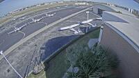
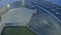
Webcams nearby
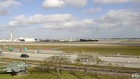
Key West - International Airport

Webcams nearby


Advertisements
Description
The thumbnail is a preview. The current webcam view is available on the external website.
Time
2026-03-15 21:11 EDT
Provider website
Refresh
Live stream
Advertisements
Weather station

Temperature: 27 °C (80 °F)
Precipitation: 0.0 mm
Cloud cover: 50%
Wind speed: 24 km/h (15 mph)
Precipitation: 0.0 mm
Cloud cover: 50%
Wind speed: 24 km/h (15 mph)
Wind direction: 123 °
Pressure: 1014 hPa
Humidity: 79%
Visibility: 16 km
Pressure: 1014 hPa
Humidity: 79%
Visibility: 16 km
Sunrise: 07:36 am
Sunset: 07:36 pm
Sunset: 07:36 pm
Moonrise: 05:26 am
Moonset: 04:32 pm
Moonset: 04:32 pm
Max temperature: 27 °C (80 °F)
Min temperature: 25 °C (76 °F)
Ultraviolet index: 1
Min temperature: 25 °C (76 °F)
Ultraviolet index: 1

Temperature: 27 °C (80 °F)
Precipitation: 0.0 mm
Cloud cover: 14%
Wind speed: 27 km/h (17 mph)
Precipitation: 0.0 mm
Cloud cover: 14%
Wind speed: 27 km/h (17 mph)
Wind direction: 137 °
Pressure: 1016 hPa
Humidity: 82%
Visibility: 10 km
Pressure: 1016 hPa
Humidity: 82%
Visibility: 10 km
Sunrise: 07:36 am
Sunset: 07:36 pm
Sunset: 07:36 pm
Moonrise: 05:26 am
Moonset: 04:32 pm
Moonset: 04:32 pm
Max temperature: 27 °C (80 °F)
Min temperature: 25 °C (76 °F)
Ultraviolet index: 1
Min temperature: 25 °C (76 °F)
Ultraviolet index: 1

Temperature: 27 °C (80 °F)
Precipitation: 2.1 mm
Cloud cover: 36%
Wind speed: 26 km/h (16 mph)
Precipitation: 2.1 mm
Cloud cover: 36%
Wind speed: 26 km/h (16 mph)
Wind direction: 190 °
Pressure: 1014 hPa
Humidity: 86%
Visibility: 10 km
Pressure: 1014 hPa
Humidity: 86%
Visibility: 10 km
Sunrise: 07:35 am
Sunset: 07:37 pm
Sunset: 07:37 pm
Moonrise: 06:03 am
Moonset: 05:31 pm
Moonset: 05:31 pm
Max temperature: 27 °C (80 °F)
Min temperature: 24 °C (76 °F)
Ultraviolet index: 2
Min temperature: 24 °C (76 °F)
Ultraviolet index: 2
Temperature: 24 °C (74 °F)
Precipitation: 0.0 mm
Cloud cover: 92%
Wind speed: 38 km/h (24 mph)
Precipitation: 0.0 mm
Cloud cover: 92%
Wind speed: 38 km/h (24 mph)
Wind direction: 95 °
Pressure: 1016 hPa
Humidity: 93%
Visibility: 10 km
Pressure: 1016 hPa
Humidity: 93%
Visibility: 10 km
Sunrise: 07:34 am
Sunset: 07:37 pm
Sunset: 07:37 pm
Moonrise: 06:37 am
Moonset: 06:29 pm
Moonset: 06:29 pm
Max temperature: 24 °C (74 °F)
Min temperature: 20 °C (67 °F)
Ultraviolet index: 0
Min temperature: 20 °C (67 °F)
Ultraviolet index: 0
Location map
Comments